Hiking route across heath-clad hilltops to the picturesque grassy meadow at Nessodden, also called Lekaskagen, where the Leka Fjord meets Røingen and the Atlantic Ocean.
From the parking area, you walk along a gravel road toward Bukkatalgen, and continue on a trail along the hilltop to the highest point at Skeisnesset, Steggafjellet (48 m.a.s.l.). From here, the landscape is hillier with some occasional wet areas. Just north of Steggafjellet Mountain, you can take a side-trip to Kalvvikene and view some conglomerates of pebbles. Some of the stones in the conglomerate actually come from the American bedrock. Further on, you pass by Helvetestjønna Pond and Jakobsteinvika Cove, known as the dwelling place of gnomes and goblins, before you finally reach the expansive grassy meadow at Nessodden.
The Family Trail is a round-trip on a gravel road in easy terrain. Short side-trip to the Stone Cottage and shoreline at is recommended. Here you can enjoy your lunch pack and go on a treasure hunt along the pebble beach.
Skeisnesset is a popular outdoor recreation area with many hiking trails. You experience a wide open heathland landscape with monumental burial mounds and magnificent views. Info signs along the way provide facts about local nature, cultural history, geology, Norse sagas and fairy tales.
Ola-Han’s Cabin is a newly built log cabin. It has 2 bedrooms with sleeping for a total of 9 guests.
The cabin has a fully-equipped kitchen with an oven, refrigerator/freezer (additional freezer available for rental fee if needed), dishwasher and heat pump.
Electricity is included in the price. Washroom with shower; dining room and lounge with TV and stereo. Wireless Internet (Wi-Fi).
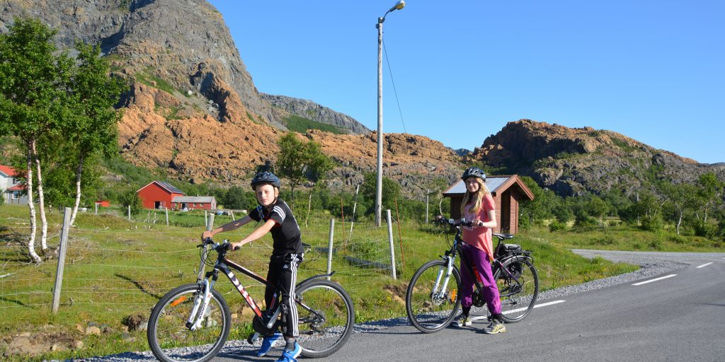
Lekamøya Spiseri (Restaurant)) is located close to the ferrylanding at Leka. Men’s, Women’s, Tandem, and Children’s bikes. Included in rental is helmet, pump, tools.
The Leka Round-trip Bike Tour is a great experience.
Leka Round-trip Bike Tour
Leka Round-trip is basically a 26-kilometre route full of non-stop sites and experiences. The route follows the asphalted – and occasionally very narrow – county road going around the island. The starting point is at Husby, 2 km from Skeishavna Harbour.
You pass through farmlands and lush areas on the island’s hospitable eastern side. Past Solsem, the landscape becomes more open and barren, and you get a look at the colourful mountains for which Leka is known.
It is nice to stop and take a side-trip from the main road both while biking or on foot – the impressions become even more intense. You can choose among many hiking trails. From the rest area at Steinstind, you get a splendid view toward the Helgeland islands and the coastal ocean. The best times to experience this is at sunset or sunrise. The outer side of Leka takes on magical colours in the evening light.
Walking tour near the shoreline with information about exciting geological phenomena on Leka. Follow the road down to Våttviksletta. From here, the trail is waymarked with small, white arrows, and it follows the rocky shoreline around Våttvikodden and northward to Vardvika.
From Vardevika, you can follow unmarked trails along the cliffs which take you further along to Bukkatalgen.
The trail is marked as a side-trip from the Støypet trail, up on a rocky hill with the fitness post “Ørnerovet”. The trail goes along fissured rock and requires some climbing. Visitors can enjoy fantastic colour variations in the rocky hillside.
The story of the Eagle Abduction really helped put Leka on the map in 1932. Three-year-old Svanhild was abducted by an eagle, but – just like in fairy tales – it fortunately ended well, and the girl was found alive after 7 hours. If you walk further in toward “ørntuva”, you will get a particularly good overview of the Eagle Abduction’s sites while having the whole landscape and backdrop for this local legend.
Bukkatalgen gets its name from an old fairy tale that explains why the rocky slope along the shoreline here is completely white. A cock, a pig and a billy goat were on a boat trip, but the boat capsized in a sudden gust of wind – and the billy-goat drowned and was washed ashore here. That is why the rocky slope – a quartz deposit – is entirely white. Bukkatalgen and its bright white colouring have long served as a landmark along the shipping lane, and is well known to seafarers. This spot gives you a view of the Leka Fjord at close proximity. They waymarked trail is suitable for use by electric wheelchairs. Follow the tractor road above the small farm at Våttvika.
Skeisnesset is a popular outdoor recreation area with many hiking trails. You experience a wide open heathland landscape with monumental burial mounds and magnificent views. Info signs along the way provide facts about local nature, cultural history, geology, Norse sagas and fairy tales.
From Ivarshallaren, you get a panoramic view of the shipping lane, the Helgeland islands and the bird conservation areas to the north and west; Skeisnesset, Leknesøyene, Hortavær and Sklinna. Follow the trail from the parking area across heather-clad hills and stay left toward the west at the first trail crossing. You pass a peat shed along the way. The last part goes up along rocky hillside.
Skeisnesset is a popular outdoor recreation area with many hiking trails – a wide open heathland landscape with monumental burial mounds and magnificent views. Info signs along the way provide facts about local nature, cultural history, geology, Norse sagas and fairy tales. The area features exciting geology and rich plant life, and the wetlands to the west are protected as a bird conservation area.
Round-trip hiking tour in the Leka Mountains:
Waymarked round-trip hiking trail in the Leka Mountains, including magnificent views and many geological treats. Designated by a German travel guide as one of the three most beautiful hiking routes in Scandinavia. Adjoining trail routes to Vattind, Kolsettuva and Hundøyrån are recommended (Note: these routes are not included in the specified distance and hiking time).
This route primarily goes through open mountain terrain with dry and solid hiking surfaces. The trail starts from Struten and goes up Tverrfjellet to Vattind. From Vattind, the route continues to Steinsvatnet Lake, and takes you near the steep western face toward Stein. Fantastic views! Proceed further along a valley with views of the Helgeland islands. From Nordtjønna, you will experience a landscape with incredibly strong colours among the rocky mountainside. During the descent to the northeast of Hundøyrån, you must go down a small scree. The final leg of the route goes along Markavegen road back to the start.
Allow yourself ample time – and perhaps even the entire day – if you want to enjoy the tour and get to see all the recommended highlights. It is easy to be taken by surprise by the coastal fog while up in the mountains. Be sure to use suitable footwear and take along extra food and windproof clothing.